|
|
|
|
| Missing In Action (MIA) | Prisoners Of War (POW) | Unexploded Ordnance (UXO) |
| Chronology | Locations | Aircraft | Ships | Submit Info | How You Can Help | Donate |
|
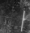
 USAAF Oct 21, 1944  USAAF Jan 7, 1945  USAAF c1945  Justin Taylan 2004 |
Location Lat 14° 38' 0" N Long 120° 59' 0" E Grace Park Airfield was located in the Grace Park subdivision in Caloocan (Kalookan) to the north of Manila in the National Capital Region (NCR) on Luzon in the Philippines. Also known as "Manila North Airfield". To the south is Manila. Today, the former airfield area is the Grace Park subdivision, between Highway 54 running perpendicular to the north and Highway 52 running diagonally parallel to the former runway. Construction Built prior to the war, it was the first commercial airfield in Manila. Used by the local airline, Philippine Aerial Taxi Company and for light aircraft service to Loakan Airfield (Baguio) and other destinations. The original runway was known as the "old runway" during World War II. Wartime History The Japanese built a concrete surface runway. They also used Highway 54 (EDSA) near the Balintawak Market as another runway. Starting in September 1944 attacked by American carrier aircraft and bombers until January 10, 1945. Curtis Brooks adds: "I was a prisoner at Santo Tomas Internment Camp throughout the Japanese occupation. Santo Tomas is about one mile south of Grace Park. We had a good view of the air activity around the air field. Grace Park was attacked by American Naval aircraft beginning in September 1944 as were all the other air fields and shipping installations in the Manila area. During the liberation of Manila in late January 1945, Grace Park Airfield was occupied by the U.S. Army and used by liaison planes including Piper L-4 Cubs and Stinson L-5 Sentinels for artillery spotting and observation flights over the Manila area. During 1945, no U.S. Army Air Force (USAAF) units were permanently based at the airfield. American missions against Grace Park December 23, 1944–January 10, 1945 SSgt Eugene Salternick recalls: "During the battle of Manila, we flew over Grace Park and I landed there in my L-5, with General Kruger as a passenger. We got out, parked the plane and he went to do his inspection. When we were ready to leave, we heard a 'whoomp' and some mortars hit nearby. I ran back to the plane, fearing that they would have destroyed it but luckily it was not hit. We took off and got out of there quickly! This mortar crew must have been watching us when we landed, luckily their round missed." James A. Russo, Jr. recalls: "During late 1945 and 1946, I was stationed at the Grace Park Airstrip, along with other certified Artillery spotter pilots flying for the Military Police, the CID and other military units. The only snap shots that I still have would be me standing alongside my L4 Piper Cub aircraft. My twin brother was also stationed there as a pilot and one picture that I have is both of us standing on the airstrip in front of some L4 aircraft. Contact me if you would care for further information." Postwar Remained in use as an airfield until at least 1946. Today Disused since the war and developed into an industrial area. The airfield is located in Kalookan on Rizal Avenue Extension between 2nd and 11th street. The area is now urban center, there is no 'park' or trace of the strip. The Japanese built runway was near the present day Gotesco Mall. Tony Feredo adds: "From the LRT at Gotesco Station, look to the east. That area used to be flat. That was the airfield. Now its with residential and commercial establishment. If you are at the monument, look southeast from the rotunda." References Index to Air Bases - Research Report No. 85, I.G. No 9185 - July 30, 1944 Terrain Handbook 41A Manila City page 39 Thanks to Tony Feredo for additional information Contribute
Information Last Updated
|
Map 1945 View in Google Earth Photo Archive |
| Discussion Forum | Daily Updates | Reviews | Museums | Interviews & Oral Histories |
|