Pacific Wrecks
Pacific Wrecks    
  Missing In Action (MIA) Prisoners Of War (POW) Unexploded Ordnance (UXO)  
Chronology Locations Aircraft Ships Submit Info How You Can Help Donate
 
    Panapae Airfield (Panapai) New Ireland Province Papua New Guinea (PNG)

Click For Enlargement
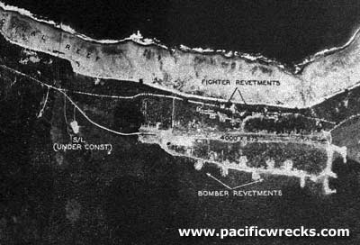
USAAF c1943

Click For Enlargement

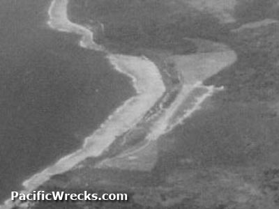
USAAF c1944
Location
Lat 2° 36' 0S Long 150° 50' 60E  Panapae Airfield was located on Panapae (Panapai) parallel to the north coast of New Ireland, two miles to the northwest is Kavieng. Also spelled Panapai Airfield or Panapai Drome.

Prewar and during the Pacific War located in the Territory of New Guinea. Today located in Tikana Rural LLG of Kavieng District in New Ireland Province in Papua New Guinea (PNG).

Prewar
Panapae plantation was established at this location by the German administration at this location planted with coconut palms harvesting copra.

Construction
Built by the Japanese on Panapai Plantation parallel to the highway and coastline. As of May 22, 1943 the single runway was 4,000' in length. A taxiway loop was located off the inland side of the runway with revetments on both sides of the runway and taxiway. The revetments included nine bomber revetments on the inland side and twelve fighter revetments on the seaward side along the runway.

Wartime History
During the Pacific War, Panapae Airfield was likely a secondary airfield to disperse aircraft as a satellite airfield for Kaveing Airfield. Staring in early February 1944 bombed by Allied aircraft until the end of the Pacific War. Occupied by the Japanese until the official surrender of Japan in September 1945.

American missions against Panapai
February 15, 1944–September 2, 1944

Today
Panapai has been disused since the Japanese operations. Kunai grass now covers the runway but the outline of the former runway can still be recognized.

Brian Bennett adds:
"I searched for any aircraft wrecks in the area in the 1980's and was unable to find much there."

Contribute Information
Do you have photos or additional information to add?

Last Updated
July 19, 2024


Google Earth
Map
April 23, 1944

Map
Map Fallingrain

Google Earth
View in Google Earth

Photos
Photo Archive
  Discussion Forum Daily Updates Reviews Museums Interviews & Oral Histories  
 
Pacific Wrecks Inc. All rights reserved.
Donate Now Facebook Twitter YouTube Instagram