|
|
|
|
| Missing In Action (MIA) | Prisoners Of War (POW) | Unexploded Ordnance (UXO) |
| Chronology | Locations | Aircraft | Ships | Submit Info | How You Can Help | Donate |
|
  USAAF October 18, 1943 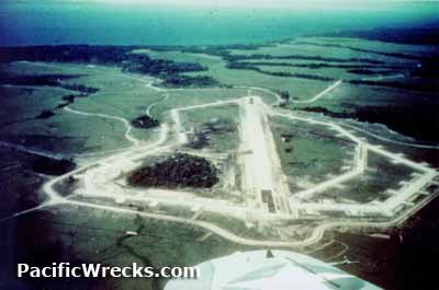 USN 1944 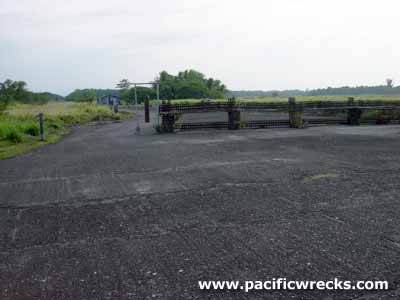 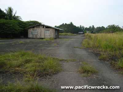 Justin Taylan 2003 |
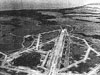
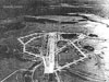
Location Koli Field was located inland from Koli Point on the north coast of Guadalcanal. To the west is the Naumbu River and beyond roughly 15 miles away is Henderson Field. To the east is the Metapona River. To the north is Crash Strip (Koli Point) and beyond Carney Field (Bomber 2) and Koli Point. Also known as Koli Airfield or Bomber 3. Prewar and during the Pacific War part of the British Solomon Islands Protectorate (BSIP). Today located in Guadalcanal Province in the Solomon Islands. Construction By early 1943, a single runway was completed oriented roughly northeast to southwest surfaced with bitumen and marston matting (PSP) with taxiways and revetments on each side. The runway was parallel to Carney Field (Bomber 2) and Crash Strip (Koli Point). By the middle of 1943 the runway was ready for use for heavy bomber operations. By January 1945 the main runway measured 7,200' x 150' and was listed as disused. Wartime History Used by the 13th Air Force (13th AF) B-24 Liberators for bombing missions in the Solomon Islands. Today Disused since the war. The former runway was used for drying copra for the nearby copra plantation. Portions of the former runway and taxiways are still used as local roads. Contribute
Information Last Updated
|
June 1, 1943 January 1945 View in Google Earth |
| Discussion Forum | Daily Updates | Reviews | Museums | Interviews & Oral Histories |
|