|
|
|
|
| Missing In Action (MIA) | Prisoners Of War (POW) | Unexploded Ordnance (UXO) |
| Chronology | Locations | Aircraft | Ships | Submit Info | How You Can Help | Donate |
|
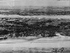 AWM April 25, 1945 |
Location Lat 5° 16' 36N Long 115° 14' 30E Labuan Island is located off the northwestern coast of Borneo. To the west is the the South China Sea. To the south is the Kuraman Channel and Brunei Bay. Beyond the east and south is Sabah State in Malaysia Borneo (East Malaysia) on Borneo. Today, Labuan Island is officially known as the "Federal Territory of Labuan" located in the Federal Territories of Malaysia. Wartime History During December 1941, occupied by the Japanese. During the Japanese occupation, renamed renamed "Maida Island" (Pulau Maida) in honor of the first Japanese commander of northern Borneo, Toshinari Maeda. Developed into a large Japanese base. Starting in early December 1944 targeted by Allied bombers and later fighters. On June 10, 1945 the U.S. Navy 7th Fleet lands the Australian Army 9th Division lands at Brunei Bay, Labuan and Muara supported by Allied aircraft. On June 15, 1945 Labuan was secured. American mssions against Labuan December 10, 1944 - June 18, 1945 Victoria (Victoria Town, Labuan) Located at the southeast corner of the island, bordering Victoria Harbor. Timbalai Airfield Located on the western coast of the island. Labuan War Cemetery Located on Labuan Island along the Jalan Tanjong Batu Road USS Salute (AM-294) Sunk June 8, 1945 by a sea mine. Australian Armed Cargo Ship Captured by Japanese and used by them lost due to mine. P-40 Force landed or crashed in shallow water. A6M2 Zero Force landed or crashed in shallow water. Contribute
Information Last Updated
|
Map 1945 Map Fallingrain |
| Discussion Forum | Daily Updates | Reviews | Museums | Interviews & Oral Histories |
|