|
|
|
|
| Missing In Action (MIA) | Prisoners Of War (POW) | Unexploded Ordnance (UXO) |
| Chronology | Locations | Aircraft | Ships | Submit Info | How You Can Help | Donate |
|
  RAAF April 11, 1945 |
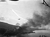
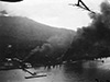
Location Lat 0° 48' 0N Long 127° 19' 60E Ternate Island is a circular volcanic island in the Molucca Island Group (Molucca Islands). Pronounced "Ter-na-te". To the east is Halmahera Island. To the south is the Bacan Islands. Prewar and during the Pacific War located in the Sultanate of Ternate in the Netherlands East Indies (NEI). Today located in North Maluku Province in Indonesia. Wartime History During the Pacific War, Ternate was occupied by the Japanese and remained an important shipping port and supply area for the region. During late 1943 until the end of the Pacific War attacked by Allied aircraft. American missions against Ternate October 17, 1943–August 16, 1944 Japanese forces occupied Ternate until the official surrender of Japan in September 1945. On November 9, 1945 the Japanese forces at Ternate Town. Afterwards, Sultan of Iskandar Muhammad Djabir, Syah of Ternate was installed plus the prewar Dutch administrator Van de Hoot. On November 17, 1945 the administration hosted Australian officials including Lady Margaret Blamey (wife of Australian Army General Thomas Blamey). Ternate Town (Kota Ternate) Located on the eastern coast of Ternate Island to the north is Ternate Island Airfield (Babullah). Spitfire Mark LF.VIII Serial Number A58-419 Pilot Stevenson force landed or ditched near shore near Dyawboela on Termate Island Contribute
Information Last Updated
|
Map 2013 Map Fallingrain Photo Archive |
| Discussion Forum | Daily Updates | Reviews | Museums | Interviews & Oral Histories |
|