 |
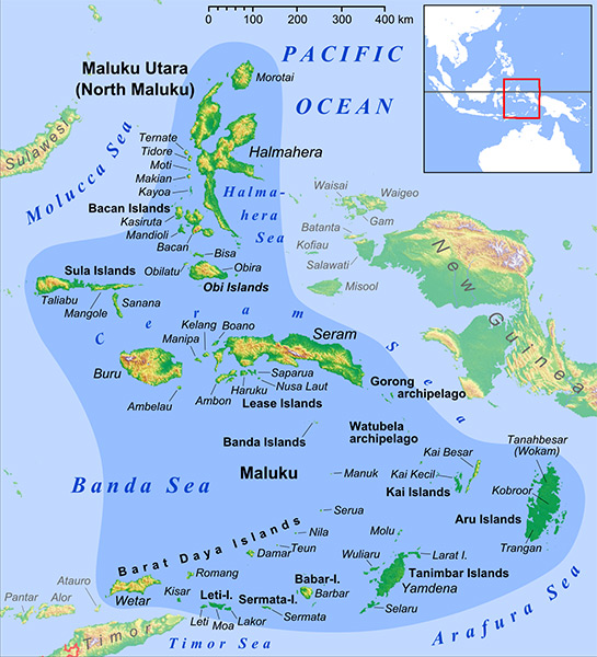
Map of Molucca Island Group (Molucca Islands) in Indonesia
Indicated in the darker blue area are the Molucca Island Group (Molucca Islands) including North Maluku Province (Provinsi Maluku Utara) and Maluku Province (Provinsi Maluku).
Locations in North Maluku Province (Provinsi Maluku Utara) include Morotai, Halmahera, Ternate, Obi Islands, Sula Islands, Seram (Ceram), Buru Island (Boeroe, Buroe), Ambon Island in the Lease Islands and Banda Islands and Rorong Archipelago.
Locations in Maluku Province (Provinsi Maluku) include Aru Islands (Aroe), Kai Islands, Tanimbar Islands, Barat Daya Islands.
At the edge of the map is Democratic Republic of Timor-Leste (East Timor) on the eastern TImor Island, the eastern arm of Sulawesi Island (Celebes) and western New Guinea of West Papua Province including the Vogelkop Peninsula and Waigeo Island.
Surrounded by the Pacific Ocean, Molucca Sea, Halmahera Sea, Ceram Sea, Banda Sea, Arafura Sea and Timor Sea.
Credit: Lencer via Wikipedia Date: 2013
B&W
High Resolution Version
Acquire This Image |
Contribute Information
Do you have photos or additional information?
Previous Page
|
|