|
|
|
|
| Missing In Action (MIA) | Prisoners Of War (POW) | Unexploded Ordnance (UXO) |
| Chronology | Locations | Aircraft | Ships | Submit Info | How You Can Help | Donate |
|
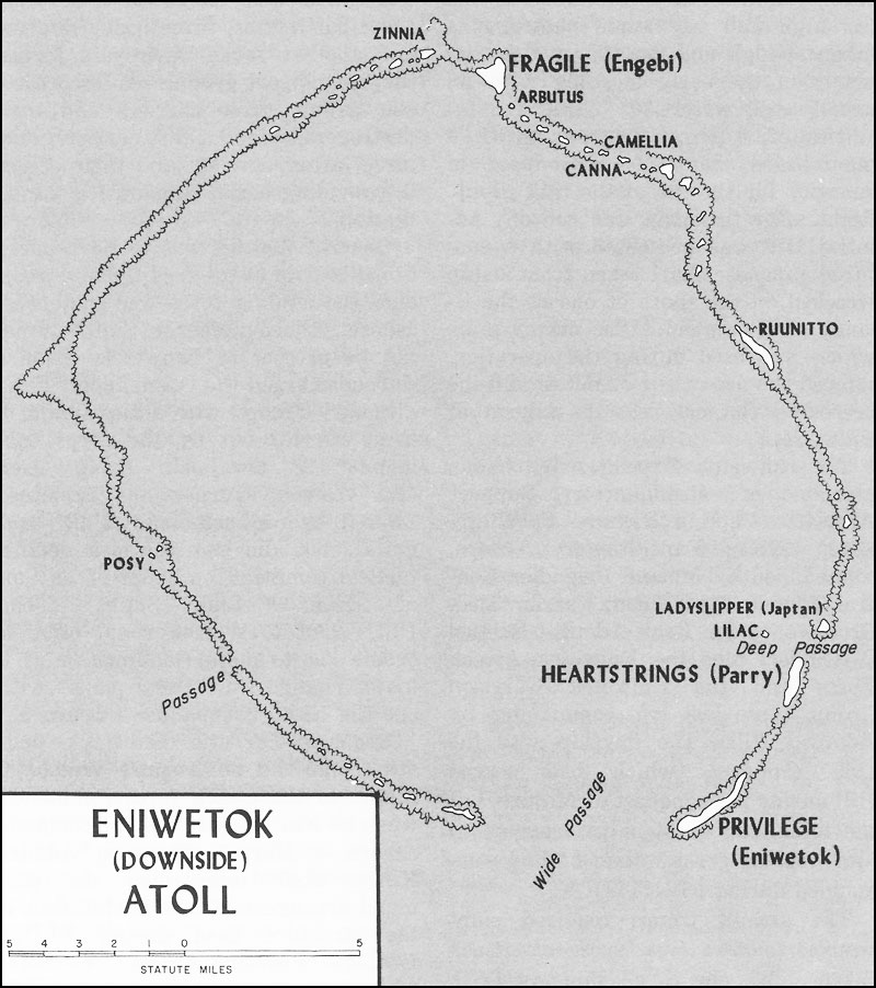
| Location Lat 9° 1' 0N Long 167° 43' 0E Eniwetok Atoll is comprised of thirty small islands, located 326 miles northwest of Kwajalein. During the Pacific War, the U.S. spelling was "Eniwetok". Today spelled "Enewetak". Also spelled "Eniewetok" or "Enewetok". Marshallese spelling Ānewetak. Wartime History During the Pacific War, Eniwetok Atoll was code named "Downside". On February 19, 1944 American forces landed on Eniwetok. Two days later on February 21, 1944 declared secured. Postwar During November 18, 1952 Kniwetok was the site of the first Hydrogen bomb (H-Bomb) test, code named "Operation Ivy". Eniwetok Island Mail island in the group, two miles long and a quarter mile wide, developed into an airfield and base. Parry Island Located just to the north-east of Eniwetok, it was code named 'Heartstrings' by the Americans. The Japanese pier was improved by the Americans and the island developed into a recreation area for 35,000 men. Engebi Island Located at the northern tip of the atoll. Code named 'Fraggile' by Americans, it was captured after a swift six hour battle on February 18, 1944. Elugelab Island On November 1, 1952 destroyed by Ivy Mike the test of the first hydrogen bomb Contribute
Information Last Updated
|
Map 1944 |
| Discussion Forum | Daily Updates | Reviews | Museums | Interviews & Oral Histories |
|