Missing In Action (MIA)
Prisoners Of War (POW)
Unexploded Ordnance (UXO)
Chronology
Locations
Aircraft
Ships
Submit Info
How You Can Help
Donate
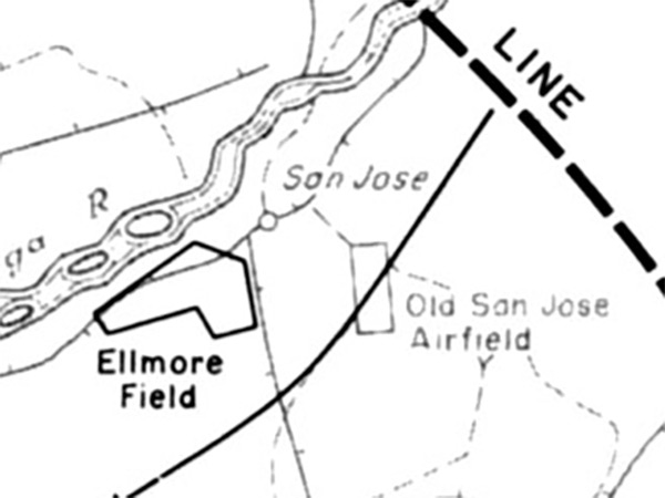
Map of
San Jose
at the southwest of
Mindoro Island
Indicated is the Bugsanga River,
Elmore Field
,
San Jose
and
Old San Jose Airfield
. The dotted line indicates the beachhead line outpost position as of
December 15, 1944
.
Credit: U.S. Army Date:
December 15, 1944
–
January 31, 1945
Map
Enlargement
High Resolution Version
Acquire This Image
|
Contribute Information
Do you have photos or additional information?
Previous Page
Discussion Forum
Daily Updates
Reviews
Museums
Interviews & Oral Histories
Pacific Wrecks Inc.
All rights reserved.