|
|
|
|
| Missing In Action (MIA) | Prisoners Of War (POW) | Unexploded Ordnance (UXO) |
| Chronology | Locations | Aircraft | Ships | Submit Info | How You Can Help | Donate |
|
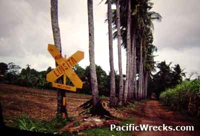 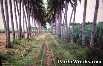  David Mason, 2000 |
Location Lat 10° 57' 30N Long 123° 10' 36E Hacienda Luisita is located at an elevation of 45' above sea level in Negros Occidental Province on Negros Island in the Western Visayas (Region VI) in the Visayas (Visayas Islands) in the central Philippines. Also known as Luisita. To the south is Highway 1 and southeast is Caduhaan (Kaduhaan). Wartime History During the Japanese occupation of the Philippines, Hacienda Luisita was occupied and built Carolina Airfield on the plantation. During late 1944 until early 1945 attacked by U.S. aircraft. American missions against Hacienda Luisita November 15, 1944 - January 19, 1945 Carolina Airfield (Carolina de la Paz, Luisita) Japanese built airfield, abandoned after 1945 Contribute
Information Last Updated
|
Map Topographic Map Fallingrain |
| Discussion Forum | Daily Updates | Reviews | Museums | Interviews & Oral Histories |
|