|  |
|
| |
|
| Missing In Action (MIA) | Prisoners Of War (POW) | Unexploded Ordnance (UXO) |
| Chronology | Locations | Aircraft | Ships | Submit Info | How You Can Help | Donate |
|
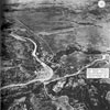 USAAF Nov 5, 1944 |
Location Lat 14° 38' 29N Long 121° 6' 42E Marikina is located at an elevation of 124' / 37m at the eastern edge of Manila in the National Capital Region (NCR) on Luzon in the Philippines. Today known as Marikina City. To the north is San Mateo. To the east is the border with Antipolo in Rizal Province, to the west is Quezon City and to the south is Pasig and Cainta. To the west is the Marikina River and beyond Manila. To the northwest was the Balera Water Filters. American missions against Marikina January 21, 1944–July 29, 1945 During January 1942 occupied by the Japanese. In December 1944, the Japanese Army under Yamashita decided to withdraw from the area and demolish bridges over the Marikina River to delay the U.S. advance. The Marikina area was occupied by the Japanese until early February 1945. By February 10, 1945 the U.S. Army 37th Division and 1st Cavalry Division had cleared all Manila and suburbs suburbs north of the Pasig River and pushed Colonel Noguchi's Northern Force either south across the Pasig River or east across the Marikina River. Marikina Airfield Located in Marikina References U.S. Army in World War II Triumph in the Philippines Chapter XIV Isolating the Battlefield pages 250, 256, 257 U.S. Army in World War II Triumph in the Philippines Chapter XXI The Reduction of the Shimbu Group Phase I: Turning the Shimbu Left pages 367-369, 371 (map) Contribute Information Do you have photos or additional information to add? Last Updated August 13, 2026 |
 Map 1945 Map Fallingrain |
| Discussion Forum | Daily Updates | Reviews | Museums | Interviews & Oral Histories |
|