|
|
|
|
| Missing In Action (MIA) | Prisoners Of War (POW) | Unexploded Ordnance (UXO) |
| Chronology | Locations | Aircraft | Ships | Submit Info | How You Can Help | Donate |
|
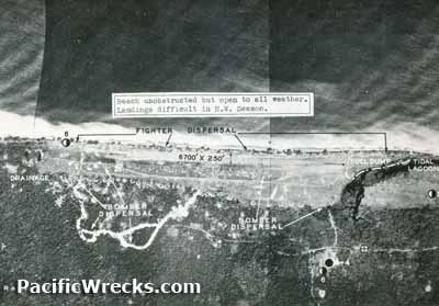 5th AF November 2, 1943 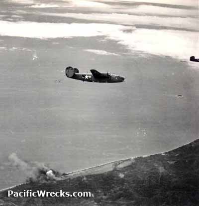 USAAF c1944 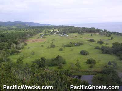 Justin Taylan 2005 |
Location Lat 3° 24' 1S Long 143° 18' 24E Dagua is located on the north coast of New Guinea. To the north is Walas Island. To the east is Dugau and further east is Wewak. To the west is But. The Wewak-Dagua coastal road spanned eastward to Wewak. Prewar and during the Pacific War located in the Sepik District of the Territory of New Guinea. Today located in East Sepik Province in Papua New Guinea. Wartime History During 1943, occupied by the Imperial Japanese Army (IJA) that built Dagua Airfield at this location parallel to the coast. Occupied by the Japanese until late March 1945. American missions against Dagua May 1943 - August 13, 1944 On March 21, 1945, Australian Army troops occupied Dagua Airfield and But Airfield. Prior to the landing, the Japanese withdrew from the coastal area and were defending five knolls along the Dagua-Wonginara Mission track leading to Tokoku Pass, and were able to fire artillery to harass the Australian on the coast. Assaulting these positions, on March 25, 1945 during fighting near Dagua, Lt. Albert Chowen earned the Victoria Cross (VC). Dagua Airfield (But East) Built by the Japanese. Neutralized by Allied bombing attacks, it was occupied by Australian troops on March 21, 1945. Disused since the war. References Australian Army in New Guinea - Dagua Contribute
Information Last Updated
|
Map 1943 Map Fallingrain Photo Archive |
| Discussion Forum | Daily Updates | Reviews | Museums | Interviews & Oral Histories |
|