|
|
|
|
| Missing In Action (MIA) | Prisoners Of War (POW) | Unexploded Ordnance (UXO) |
| Chronology | Locations | Aircraft | Ships | Submit Info | How You Can Help | Donate |
|
 Halmarick Dec 29, 1943 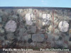 Justin Taylan 2003 |
Location Lat 9° 28' 60S Long 147° 10' 60E Kila Kila located at an elevation of 62' / 18m above sea level east of Port Moresby inland from the southern coast of New Guinea. Also known as 3-Mile or simply Kila (one word) or Kila Kila Number 1. To the east is the Stokes Range and to the south Kila Bay on the south coast of New Guinea. Prewar and during the Pacific War located in the Territory of Papua. Today located in the National Capital District (NCD) in Papua New Guinea (PNG). Kila Drome (3 Mile, Kila Kila) Prewar Port Moresby airfield, used and expanded during the war. Today abandoned. Horse Camp An area near Kila Kila Drome (3 Mile Drome) was known as "Horse Camp" for a U.S. Army cavalry unit stationed at this location. The name Horse Camp is still in use today. PNG War Contributions Memorial This memorial is located on the road above town. Four silhouettes depict the roles Papua New Guinea people played during the war: Volunteer Rifles, Carriers, Stretcher Bearers and scouts. Sadly, the memorial has been graffiti, and covered in beetle nut juice as it is near a small market where people congregate. Bruce Hoy recalls from the 1970: "A B-24 was at the intersection of the Taurama and Rigo Roads. Also, a B-24 behind the village on the way to Pari. When I was last there, it still had wire-wrapped 100-lb bombs lying around." B-17E Flying Fortress Serial Number 41-2445 Pilot Freeman crashed December 2, 1942 Contribute
Information Last Updated
|
Map Fallingrain Map Mapcarta |
| Discussion Forum | Daily Updates | Reviews | Museums | Interviews & Oral Histories |
|