Location
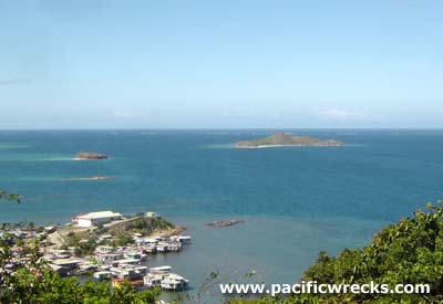
Joyce Bay borders the southern coast of New Guinea. Vabukori is to the west and Pari is to the southeast. To the northwest is Port Moresby. To the southeast is Pyramid Point. To the west is Local Island (Manubada). Beyond to the southwest is Nateara Reef. Prewar, the Pari Road connected Port Moresby to the western edge of Kila Drome (Kila Kila) facilitating road access to Joyce Bay and Pari. Prewar and during the Pacific War located in the Territory of Papua. Today located in the National Capital District (NCD) of Papua New Guinea (PNG).
Wartime
During the Pacific War, Pari village was in close proximity to Allied bases and camp areas and was frequently visited by Allied personnel to interact with villagers, watch sing sing dances or purchase artifacts.
Contribute
Information
Do you have photos or additional information to add?
Last Updated
March 20, 2022
|