 |
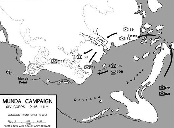
Map Munda Campaign XIV Corps 2-15 July
The map indicates Munda (Munda Point), Munda Airfield and Zanana on the southern coast of New Georgia. Borders Roviana Lagoon and offshore islands including Roviana Island, Sasavele Island (Dume Island), Onaiavisi Channel and Baraulu Island Roviana Island . The black line indicates the July 2, 1943 to July 3, 1943 landings by U.S. Army, 43rd Infantry Division, 172nd Infantry Regiment and 169th Infantry Regiment at Zanana and their advance westward to Barike River by July 9, 1943 and the block outline indicates the front lines as of July 15, 1943 against elements of the Imperial Japanese
Army (IJA) 229nd Infantry Regiment.
Credit: U.S. Army Map 5 Date: July 2-15, 1943
Map
High Resolution Version
Acquire This Image |
Contribute Information
Do you have photos or additional information?
Previous Page
|
|