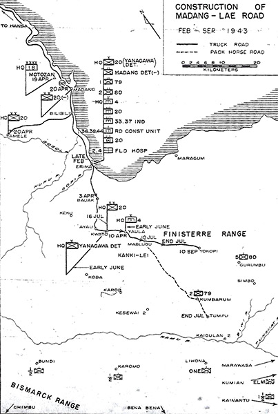
Map of Construction of Madang-Lae Road Feb-Sept 1943
The maps shows the north coast of New Guinea including the Finisterre Range and Ramu Valley. Coastal locations include from north to south: Hansa Bay, Motozan (Amron), Madang, Madang Airfield, Bilbili, Amele, Erima, Bodadjim and Maragum. Rivers include:
Gogol River, Nuru River, Gori River.
Rivers include:
Gogol River, Nuru River, Gori River, Ramu River, Biwi River and Tunkuat River.
(Black line): Truck Road: Bodadjim Road (Bogadjim-Yaula Road) including Bauak, Ayau, Kwato, Yaula, Mablugu, Yokopi.
(Dotted line) Pack Horse Road: Mablugu, Kumbarum, Dumpu (Tumpu).
In the Ramu Valley is Kaigulan 2, Lihona, Karomo, Bundi, Marawasa, Kumian
Arrows indicate the approximate direction of Bismarck Range (Highlands) locations including Chimbu, Bena Bena, Kainantu
Credit: Mono. No. 38 page 164 Date: February 1943–September 1943
Map
High Resolution Version
Acquire This Image |
Contribute
Information
Do you have photos or additional information?
Make A Donation | Previous Page | Pacific Wrecks |