|
|
|
|
| Missing In Action (MIA) | Prisoners Of War (POW) | Unexploded Ordnance (UXO) |
| Chronology | Locations | Aircraft | Ships | Submit Info | How You Can Help | Donate |
|
 Tony Feredo 2004 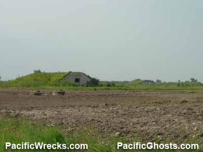 Justin Taylan 2005 |
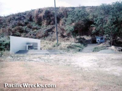
Location Mabalacat West Airfield was located to the west of Highway 3 (MacArthur Highway) and railroad to the west of Mabalacat in Pampanga Province on Luzon in the Philippines. To the southwest is Clark Field. To the northeast is Mabalacat East Airfield (Mabalacat No 2, Kamikaze East). Construction Prior to development, the area was flat farm land planted with rice. Prewar, a single runway was built at this location by the U.S. Army as a landing ground. Wartime History During the Japanese occupation of the Philippines, used as a military airfield. Tony Feredo adds: "Photos taken at Mabalacat West revealed a rivalry of IJN and IJA aircraft together and in some instances, IJA and IJN units were assigned in some bases." Today The former airfield area is located inside the Clark Air Base compound area. Post war, the area was developed into a bomb dump area by American military, with concrete bomb storage hangars. Today, the area is abandoned. There is a memorial and tunnel present at the former airfield. Contribute
Information Last Updated
|
Map 1944 Map Fallingrain Photo Archive |
| Discussion Forum | Daily Updates | Reviews | Museums | Interviews & Oral Histories |
|