 |
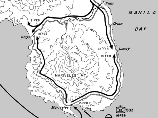
Map of Clearing Bataan February 12-21, 1945
Depicts U.S. Army liberation of Bataan Peninsula on Luzon. On February 14, 1945 "South Force" made an amphibious landing inside Mariveles Harbor at Mariveles and split with one group advancing to the northeast and by February 18, 1945 reached Limay with another advance to the northwest along a trail to Bagac by February 21, 1945. Meanwhile, on February 12, 1945 the "East Force" black solid line indicates their advance to Orani then southward along the eastern coast and by February 16, 1945 reached Limay. Indicated is the Bataan Peninsula on Luzon including Pilar, Orion, Limay and Mariveles connected by road with a trail leading to Bagac. Also indicated is Mount Mariveles (Mt. Mariveles). At the lower edge is the North Channel with Manila Bay to the east and the South China Sea to the west
Credit: U.S. Army Map 15 by F. Temple Date: February 12-14, 1945
B&W Enlargement
High Resolution Version
Acquire This Image |
Contribute Information
Do you have photos or additional information?
Previous Page
|
|