|
|
|
|
| Missing In Action (MIA) | Prisoners Of War (POW) | Unexploded Ordnance (UXO) |
| Chronology | Locations | Aircraft | Ships | Submit Info | How You Can Help | Donate |
|
 Justin Taylan 2006 |
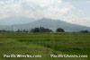
Location Lat 14° 39' 36N Long 120° 33' 55E Pilar is located at an elevation of 22' / 6m above sea level on the eastern coast of the Bataan Peninsula in Bataan Province on Luzon in the Philippines. Connected by road along the coast northward to Orani and southward to Orion and beyond. To the west is Balanga. Borders Manila Bay to the east. Mount Samat National Shrine (Mt. Samat National Shrine) Allied forces used Mount Samat during the defense of Bataan, and were bombarded by Japanese artillery from Balanga. Located at Diwa, Pilar, at end of a well-marked road off Governor Linao Highway 7.7 km west of the junction with the Roman Highway. Open Daily 8am - 9pm. Admission is 30 pesos +10 for elevator. This memorial is a 300' tall cross. An elevator goes to the top viewing gallery with sweeping views and a memorial depicting the battle. Pilar Airfield Used during the defense of the Philippines References U.S. Army in World War II - Triumph in the Philippines Chapter XVII: Back to Bataan pages 332, 333 (map), 334 Contribute
Information Last Updated
|
Map Feb 12-21, 1945 Map Fallingrain |
| Discussion Forum | Daily Updates | Reviews | Museums | Interviews & Oral Histories |
|