 |
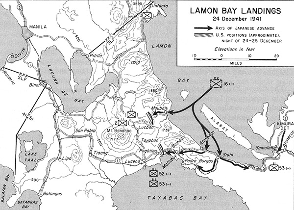
Map of Lamon Bay Landings 24 December 1941
The black line with arrow indicates the axis of Japanese advance. The solid line with hatching indicates U.S. positions (approximate) night of 24-25 December 1941. The map includes Lamon Bay bordering the eastern coast of Luzon. Also indicated is Infanta, Alabat Island, Mauban, Siain (Plaridel) and Atimonan, Sumulong, Aloneros, Mount Banahao, Lucban, Tayabas, Pagbilao, Lucena, Tiaong, San Pablo, Binan, Rosario, Cavite, Manila, Lake Taal, Balayan Bay, Batangas Bay, Batangas, Lipa, Laguna De Bay and Tayabas Bay with the Kimura Detachment advancing along Route 1 at the eastern edge of the map.
Credit: U.S. Army Date: December 24, 1941–December 25, 1941
Map
High Resolution Version
Acquire This Image |
Contribute Information
Do you have photos or additional information?
Previous Page
|
|