|
|
|
|
| Missing In Action (MIA) | Prisoners Of War (POW) | Unexploded Ordnance (UXO) |
| Chronology | Locations | Aircraft | Ships | Submit Info | How You Can Help | Donate |
|
   Justin Taylan 2005 |
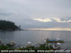
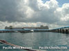
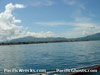
Location Batangas Bay borders the southern coast of Luzon spanning from the Calumpan Peninsula to the west and Batangas (Batangas City) to the east with Matoco Point at the southeastern tip. Offshore to the southwest is the Maricaban Strait and to the south is Maricaban Island, Verde Island Passage and Mindoro Island. Wartime History During November 1941 Batangas Bay was selected for as a landing site for the Japanese Army 16th Division (less 9th Infantry and 33d Infantry) plus supporting units under the command of Lt. Gen. Susumu Morioka but due to intelligence that reported U.S. reinforcements, their landing was switched to more distant Lamon Bay. Japanese and American missions against Batangas Bay December 10, 1941–April 28, 1945 Today The port of Batangas is used by ships and ferry boats bound for nearby Mindoro Island. Batangas Bay is a popular dive spot with many reefs and sites for divers. There are several known shipwrecks. One is a capsized barge (identity unknown) in 15-50' at 'Twin Rocks' the other is a ferry sunk postwar. References U.S. Army in World War II - The Fall of the Philippines Chapter VIII: The Main Landings pages 139 Contribute
Information Last Updated
|
Map Fallingrain |
| Discussion Forum | Daily Updates | Reviews | Museums | Interviews & Oral Histories |
|