|
|
|
|
| Missing In Action (MIA) | Prisoners Of War (POW) | Unexploded Ordnance (UXO) |
| Chronology | Locations | Aircraft | Ships | Submit Info | How You Can Help | Donate |
|
  20th CMS April 1, 1944 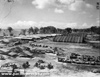 U.S. Army 1944 |
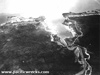
Location Lat 6° 35' 60S Long 147° 50' 60E Finschafen is located on the Huon Peninsula on the north coast of New Guinea. Borders Dregerhaffen Harbor (Dreger Haffen Harbor) to the south. Borders Langemak Bay (Langemark , Langemaak) to the north. Located 50 miles east of Lae. There are several variations in the spelling of this Finschafen during different historical periods. During the German colonial era, spelled "Finschhafen". Prewar and during the Pacific War, spelled Finschafen, Finschaffen or Finchhaven. Today spelled "Finschhafen" located in Morobe Province in Papua New Guinea (PNG). Prewar Founded in 1885, the town was established by the Deutsch-Neuguinea Kompagnie (German New Guinea Company) as their first settlement in New Guinea, which was unsuccessful due to malaria and tropical diseases. In 1892, many German colonists moved west to Stephansort (Bogadjim). Prior to the Pacific War, a Lutheran mission was established with 80 missionaries that ran several missions, schools, a port and a radio station. Wartime History On March 10, 1942 the Japanese Army occupied the area and used the Lutheran Mission buildings as their headquarters. The Allies thought the area was lightly defended, but in fact based the fresh Japanese 20th Division (less 78th Regiment) and a Special Naval Landing Force and Naval Base Unit occupied the area. Allied and Japanese mission against Finschafen December 21, 1942–January 5, 1944 On September 22, 1943 at dawn U.S. Navy (USN) Rear Admiral Daniel E. Barbey's Task Force 76 (TF-76) landed the Australian Army, 20th Brigade under the command of Brigadier J. V. Windeyer at Scarlet Beach six miles north of Finschhafen. Simultaneously the 22nd Australian Militia approached from the coast. After a week of hard fighting, the Australians captured the town of Finschhafen and Finschafen Airfield (Prewar) by October 2, 1943. During the battle, the Japanese lost roughly 1,500 troops. But the victory was, in a sense, a hollow one, for the bulk of the Japanese garrison, 4,000 men retreated Sattleberg, a peak that dominated Finschhafen and the surrounding area. Afterwards, Finschafen was developed into a major Allied base known by the U.S. Army as "Base F (Finschafen)". The U.S. Army built Finschafen Airfield (Dreger Field) and developed the facilities at Dreger Haffen Harbor. Finschafen became an important base to support Allied island hopping operations and for training and support until the end of the Pacific War and remained in use until the late 1940s. African American (Negro) soldiers at Finschafen 2026th Quartermaster Co. 466th Quartermaster Co. 467th Quartermaster Co. 469th Quartermaster Co. 466th Antiaircraft Artillery AW Battalion 742nd Antiaircraft Artillery Gun Battalion 49th Coast Artillery Battalion, 155mm Howitzer 772nd Engineer Dump Truck 579th Motor Ambulance Co. 637th 638th, 639th Port Co. 248th Quartermaster Depot Co. 437th Aviation Squadron 97th Engineer Service Regiment 570th, 557th Quartermaster Battalion 986th Quartermaster Co. 985th Quartermaster Co. Postwar Finschafen continued to be used in the immediate postwar period. U.S. Army American Graves Registration Service (AGRS) maintained American Cemetery at Finschafen (Finschaffen Cemetery) and processed recovered remains until the late 1940s. When the Americans abandoned Finschafen, most of the equipment was abandoned, buried or otherwise disposed. Today Little of the prewar town, remains except for one old Lutheran building that remains in use by missionaries as a holiday home. The tower was used as a lookout point during the war year. Postwar, the town of Finschafen was moved from the original site to a new location. Finschafen Airfield (Dreger Field) Built by Americans, developed into an important fighter and transport base Finschafen Airfield (Prewar Airfield) Built prior to the war by Lutheran Missionaries Scarlet Beach Located roughly six miles north of Finschhafen, site of the Australian Army landing on September 22, 1943. Kakakog (Kakakogwith) Crest line overlooking Finschhafen and Scarlet Beach, battle between September 24-October 2, 1943. 119th Station Hospital Built at Finschafen and was often swamped with malaria patients, just as the Germans had experienced during the colonial era. Veteran Don Hubner, 1st Marine Division recalls: "Evidently this unhealthy situation on Goodenough Island prompted those in authority to move the First Marine Division on over to New Guinea and under the jurisdiction of MacArthur's Sixth Army stationed around Finschafen." American Cemetery at Finschafen (Finschaffen Cemetery) Finschafen Cemetery was created by the U.S. Army for American dead. It included five separate cemeteries: USAF Cemetery, Fischaffen #1, USAF Cemetery, Fischaffen #2, USAF Cemetery, Fischaffen #3, USAF Cemetery, Fischaffen #4, USAF Cemetery, Fischaffen #5. Post war, all graves were exhumed and the remains were transported to either Manila American Cemetery, Hawaii Memorial Cemetery (Punchbowl) or to the United States for permanent internment. American units based in Finschafen 1st Marine Division - from Goodenough and Finschafen to Cape Gloucester African-Americans service units U.S. Army Road Grater Abandoned near the road to Sattleburg C-47A Dakota 43-30746 Crashed, circumstances unknown P-38H Lightning 42-66547 Pilot Garrison MIA September 22, 1943 Unknown Shipwreck at Finschafen Japanese shipwreck of 150 tons Ume Maru Sunk off Finschafen References AWM "Development of Finschafen as a base" F07478 cine footage of Finschafen c1944 Contribute
Information Last Updated
|
Map Fallingrain Photo Archive |
| Discussion Forum | Daily Updates | Reviews | Museums | Interviews & Oral Histories |
|