 |
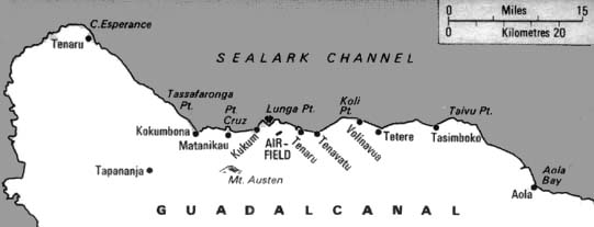
Map of the north coast of Guadalcanal bordering the Sealark Channel and Iron Bottom Sound
(West to East): Tenaru, Cape Esperance, Kokumbona, Matanikau, Point Cruz, Kukum, Lunga Point, [Airfield] Henderson Field, Mt. Austen, Tenaru, Koli Point, Tasimboko, Tetere, Talvu Point, Aola and Aola Bay.
Credit: USMC Date: 1942
Map
High Resolution Version
Acquire This Image |
Contribute Information
Do you have photos or additional information?
Previous Page
|
|