|
|
|
|
| Missing In Action (MIA) | Prisoners Of War (POW) | Unexploded Ordnance (UXO) |
| Chronology | Locations | Aircraft | Ships | Submit Info | How You Can Help | Donate |
|
 USN Oct 11, 1943 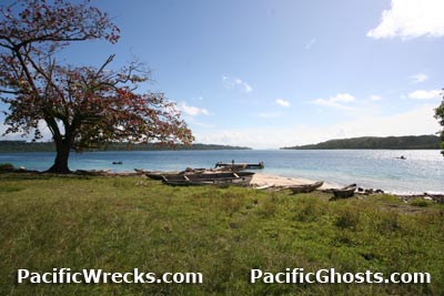 Justin Taylan 2005 |
Location Lat Lat (DMS) 7° 6' 28S Long (DMS) 155° 50' 41E Maleai village located at an elevation of 3' above sea level on the eastern tip of Magusaiai Island in the Shortland Island Group (Shortland Islands). To the east borders Tuha Channel and Poporang Island and Shortland Island. Wartime Allied spelling "Malai" or "Maliai". Prewar and during the Pacific War part of the British Solomon Islands Protectorate (BSIP). Today part of Western Province in the Solomon Islands. Prewar A prewar Catholic mission church was built at this location. Wartime History On March 30, 1942 occupied by the Japanese when they arrived in the Shortland Islands. Occupied by the Japanese until the official surrender of Japan in September 1945. American missions against Magusaiai and Maleai September 6, 1943–January 6, 1944 F1M2 Pete Manufacture Number 5269 Tail P-2 Crashed on the island, salvaged after 2005 and removed by Craig Turner 2007 Contribute
Information Last Updated
|
Map Fallingrain |
| Discussion Forum | Daily Updates | Reviews | Museums | Interviews & Oral Histories |
|