|
|
|
|
| Missing In Action (MIA) | Prisoners Of War (POW) | Unexploded Ordnance (UXO) |
| Chronology | Locations | Aircraft | Ships | Submit Info | How You Can Help | Donate |
|
 USN October 11, 1943  Justin Taylan 2003 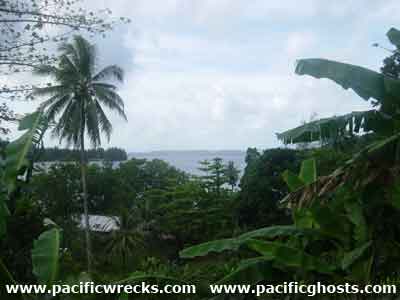 Justin Taylan 2003 |
Location Lat 7° 4' 46S Long 155° 51' 51E Korovou is located at an elevation of 19' / 5m on the southeast of Shortland Island. in the Shortland Island Group (Shortland Islands). To the northeast is Faisi Island. To the south borders Tuha Channel and beyond Poporang Island. To the east is Shortland Harbor. To the north borders Kulitana Bay and beyond Lofang. Also spelled Korouvo. Allied wartime spelling Korovo. Prewar and during the Pacific War part of the British Solomon Islands Protectorate (BSIP). Today part of Western Province in the Solomon Islands. Prewar Bumbugiai Plantation (Bambagiai, Bambuggiai) was established at Korovou planted with coconut palms harvesting copra. At Korovou, a wharf was constructed that facilitated the loading of copra onto ships for export. Nearby were buildings and huts for copra storage and administration. These were the only permanent structures on Shortland Island prior to the Pacific War. Wartime History On March 30, 1942 around 2:00am, Imperial Japanese Navy (IJN) warships entered Shorthand Harbor and landed two Special Naval Landing Force (SNLF) platoons that encountered no resistance. One platoon remained in the area to begin establishing Shorthand Harbor Seaplane Base. Occupied by the Japanese for the duration of the Pacific War. This area was defended by anti-aircraft guns and fortifications. Allied missions against Korovou (Korouvo) June 30, 1943–1943 Today Postwar, Korovou became the subprovincial headquarters of Western Province. Today, traces of wartime bunkers and fortifications. Piles of Japanese beer bottles remain in the area. Contribute
Information Last Updated
|
Map April 11, 1943 Map Fallingrain |
| Discussion Forum | Daily Updates | Reviews | Museums | Interviews & Oral Histories |
|