|
|
|
|
| Missing In Action (MIA) | Prisoners Of War (POW) | Unexploded Ordnance (UXO) |
| Chronology | Locations | Aircraft | Ships | Submit Info | How You Can Help | Donate |
|
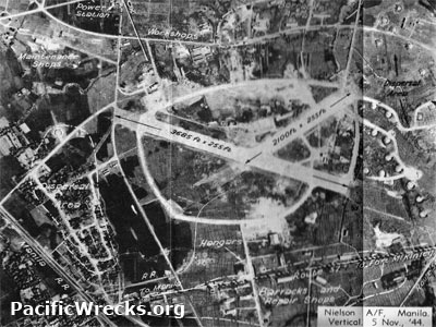 November 5, 1944 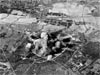 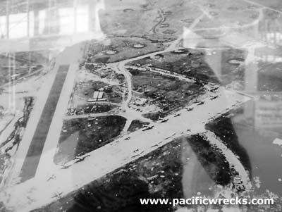 USAAF 1945 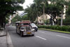 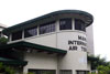 Justin Taylan 2009 |
Location Lat 14° 34' 0" N Long 21° 1' 0" E Nielson Field was located at Paseo De Roxas Road and Ayala Avenue in Makati in southern Manila in the National Capital Region (NCR). of Luzon in the Philippines. Construction Built prewar by the Americans as an airfield. The airfield had two intersecting runways, the main runway NW/SE and a smaller runway running NE to SW, with taxiways that connected both, plus dispersal areas in the surrounding area. Named Nielson Field after New Zealander Laurie Reuben Nielson who was a businessman and aviation enthusist in the Philippines. Prewar Used by American Far Eastern Aviation and Philippine Airlines (PAL) as a civilian airport. Wartime History When the threat of war loomed, Nielson was take over by the FEAF and enlarged with hangars, workshops and facilities. FEAF's Manila Air Depot where new aircraft were assembled and equipment stored. During early January 1942 occupied by the Japanese Army and used as a military airfield during the Japanese occupation of the Philippines. On November 5, 1944 the main runway measured 3,685' x 255' and the second runway measured 2,100' x 255'. Japanese units based at Nielson Field 51 Hikoshidan Shirebu Hikohan (51st Air Brigade) Ki-49 American missions against Nielson Field January 26, 1942–January 9, 1945 American Usage During March 1945 liberated by the U.S. Army. Many Japanese planes were captured including: Ki-49 Helen 3567. Rapidly, Nielson Field was repaired and again used as an American airfield. By July 1, 1945, the old SE/NW runway is now used for aircraft parking only. The main runway was surfaced with asphalt and gravel, expanded to 6,000' x 100' with a 500' overrun on each end and 25' shoulders. Field equipped for night operation, repairs with gas, oil and accommodations. For the remainder of 1945, Nielson Field was also known by the U.S. Army as APO 75. American Units based at Nielson Field 374th TCG, 33rd TCS (C-47) from Hollandia April 8, 1945 - ? 374th TCG HQ (C-47s) from Biak May 28, 1945 - ? 374th TCG, 22nd TCS (C-47) Finschafen arrives August 1, 1945–January 31, 1946 inactivated Postwar In 1947 Nielson was closed as an airfield. Afterwards, the land was used for commercial development. The main runway is Paseo De Roxas Road and the tarmac area is now Ayala Avenue. Today The former airfield area became the commercial center of Makati. The former Nielson Tower (Manila Internation Air Terminal Building) is the only original building that remains. Nielson Tower (Manila Internation Air Terminal Building) The original tower and air terminal building. Today operated by the Ayala Museum and a restaurant Nielson Tower Club & Restaurant today Blackbird Makati. References Terrain Handbook 41A Manila City, page 34-35 map 18 Index to Air Bases - Research Report No. 85, I.G. No 9185 - July 30, 1944 Contribute
Information Last Updated
|
Photo Archive Map 1945 |
| Discussion Forum | Daily Updates | Reviews | Museums | Interviews & Oral Histories |
|