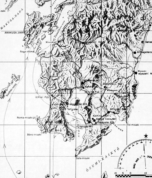
Map of southern Kyūshū Island including the Kagoshima Bay area
The line with arrow indicates the flight route of
USS Yorktown (CV-10) TBM Avengers from VT-9 led by Lt. Thomas H. Stetson on a mission over southern Kyūshū and bombing attack against Chiran Airfield hangars and strafing parked planes then depart to the south. Also indicated is Kushira Airfield, Kanoya Airfield, Kanoya East Airfield, Takayama Airfield and Shibushi Airfield and Shibushi Bay (Shibushi Wan). Credit: NARA VT-9 War History (map) page 168 Date: March 29, 1945
B&W