Missing In Action (MIA)
Prisoners Of War (POW)
Unexploded Ordnance (UXO)
Chronology
Locations
Aircraft
Ships
Submit Info
How You Can Help
Donate
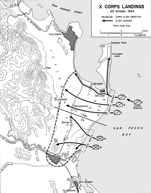
Map of X Corps Landings 20 October 1944
The black arrows indicate the A-Day advance routes. The dotted line indicates the X Corps A-Day objectives. The dotted line indicates the Corps boundry between
1st Cavalry
and 24th Division. The initial landings were at Red Beach north of
Palo
and White Beach at San Jose near
Tacloban
. The map includes locations on eastern
Leyte
including
Tacloban
and
Tacloban Airfield
,
Palo
, Highway 1, Highway 2,
Hill 522 (Guinhangdan Hill)
and
San Joaquin
. Borders
San Juanico Strait
and
San Pedro Bay
inside
Leyte Gulf
.
Credit: U.S. Army Date:
October 20, 1944
Map
High Resolution Version
Acquire This Image
|
Contribute Information
Do you have photos or additional information?
Previous Page
Discussion Forum
Daily Updates
Reviews
Museums
Interviews & Oral Histories
Pacific Wrecks Inc.
All rights reserved.