|
|
|
|
| Missing In Action (MIA) | Prisoners Of War (POW) | Unexploded Ordnance (UXO) |
| Chronology | Locations | Aircraft | Ships | Submit Info | How You Can Help | Donate |
|
 USN October 24, 1944 |
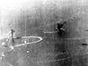
Location Leyte Gulf is a body of water in the in the Eastern Visayas (Region VIII) in the Visayas (Visayas Islands) in the central Philippines. Borders Samar to the north, Leyte to the west, Homonhon Island to the east and Surigao Strait and Dinagat Island to the south. Wartime History On October 20, 1944 a U.S. Navy (USN) 7th Fleet crossed from Leyte Gulf with a portion of the force turning southward into Surigao Strait while the rest of the force with X Corps and XXIV Corps landed on eastern Leyte. Battle of Leyte Gulf The Battle of Leyte Gulf during October 23-26, 1944 was a series of engagements including the The Battle of the Palawan Passage, Battle of the Sibyuan Sea, Battle of Surigao Strait, Battle Off Samar (Battle of Samar) and Battle off Cape Engaño. Michishio Sunk October 25, 1944 by gunfire and torpedoes from USS McDermutt and USS Hutchins. B-25D "Shifless Skonk" 41-30765 Pilot Burnham MIA September 6, 1945 over Leyte Gulf FM Wildcat Sunk into Leyte Gulf off Samar Contribute
Information Last Updated
|
Map Oct 20, 1944 Map Fallingrain |
| Discussion Forum | Daily Updates | Reviews | Museums | Interviews & Oral Histories |
|