|
|
|
|
| Missing In Action (MIA) | Prisoners Of War (POW) | Unexploded Ordnance (UXO) |
| Chronology | Locations | Aircraft | Ships | Submit Info | How You Can Help | Donate |
|
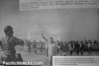 US Army January 9, 1945 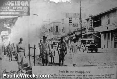 U.S. Army Jan 12, 1945  Justin Taylan 2005 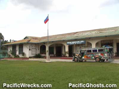 Justin Taylan 2005 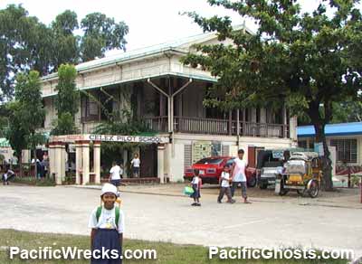 Justin Taylan 2005 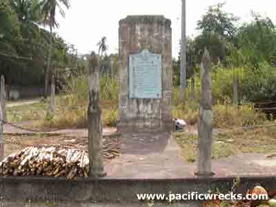 Justin Taylan 2005 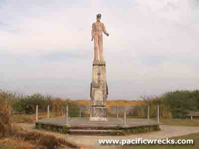 Justin Taylan 2005 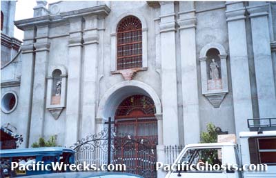 Justin Taylan 2005 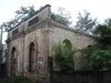 V. Revita 2009 |
Location Lat 16° 6' 0N Long 120° 31' 0E Dagupan is a located at an elevation of 164' / 49m in the 4th District of Pangasinan Province on Luzon in the Philippines. To the north is Bonuan (Blue Beach) and beyond Lingayen Gulf. To the west is Lingayen and to the east is San Fabian. Wartime History On January 9, 1945 in the morning, U.S. Army Sixth Army landed at Bonuan (Blue Beach) on the coast north of Dagupan and quickly occupied the town. On January 11, 1945 organized at Dagupan was U.S. Marine Corps (USMC) Marine Aircraft Groups, Dagupan, commanded by Colonel Clayton C. Jerome. On January 12, 1945 three days after the initial landing, General Douglas MacArthur tours Dagupan as part of his official return to Luzon and is photographed walking on Fernandez Avenue, and stayed at the West Central Elementary School in the center of Dagupan. Dagupan Museum This museum is free and is located in the center of town, across from the town hall and park. Inside the second story of the building is a small collection of historical artifacts from the city cathedral prior to renovation and several WWII era relics of helmets. Also, there are large copies of WWII photos taken when MacArthur landed and toured around the town. Outside in a park is rail road locomotive #17 that used to travel on the rail line that began in Manila and terminated in Dagupan. West Central Elementary School This elementary school is located across from the museum. This school is still in use to this day as an elementary school. It was at this location that Then & Now West Central Elementary School. MacArthur House At the school, he stayed in an old house located to the north side of the school, known afterwards as the 'MacArthur House'. Today, the house is used by the school as a home economics building and preschool, but is open to visitors for free tours, see the school's principal for access. The building is in deteriorating condition. All the room were used by MacArthur, including the large bath tub on the second floor. Bonuan (Blue Beach) Beach at Dagupan where US Army forces landed on January 9, 1945 and MacArthur landed with cameras rolling on December 12, 1945. Today, on the beach there is a memorial plaque, and statue of General Douglas Macarthur. Fernandez Avenue Street in Dagupan. MacArthur toured this street after the January 9, 1945 landing. A. G. Noriega Jewelry Store was open at that same location until 1990. Then & Now Fernandez Avenue. Luzon Landing Plaque A small memorial ringed by bullet shaped chain fence reads: "Luzon Landing - On this shore, known as Blue Beach, Bonuan, Dagupan City, the first combat troops of the sixth army of the United States of America under the command of General Douglas MacArthur landed on 9 January 1945 to liberate the island of Luzon thus fulfilling his promise to the Filipino people: 'I shall return' " Macarthur Statue Located at the edge of the beach, beach at Donuan, just outside Dagupan is this statue of General Douglas Macarthur. In 2003, the park was semi-overgrown, and decrepit. Plaques on the base of the statue read: 'Defenders of Bataan and Corregidor' and 'WWII Guerrillas - It Can Be Done'. Dagupan Cathedral Catholic Church in Dagupan. Dagupan Train Station Built by the Spanish, and opened in 1892 as the The Manila-Dagupan line of the Manila Railway Company Limited. Today, it is abandoned. Contribute
Information Last Updated
|
Map January 9-17, 1945 Map Lingayen Area 1945 Map Mapcarta |
| Discussion Forum | Daily Updates | Reviews | Museums | Interviews & Oral Histories |
|