|
|
|
|
| Missing In Action (MIA) | Prisoners Of War (POW) | Unexploded Ordnance (UXO) |
| Chronology | Locations | Aircraft | Ships | Submit Info | How You Can Help | Donate |
|
 Justin Taylan 2003 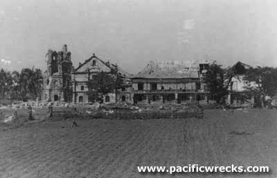 Carl R. Thien 1945 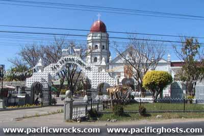 Justin Taylan 2003 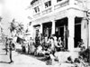 Justin Taylan 2003 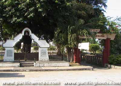 Justin Taylan 2003 |
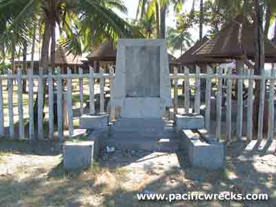
Location Lat 16° 7' 42N Long 120° 24' 39E San Fabian is located at an elevation of 108' / 32m in Pangasinan Provincein the Ilocos Region (Region I) of northern Luzon in the Philippines. To the northeast borders Lingayen Gulf. To the north is the provincial border with La Union Province and Damortis. To the southwest borders Dagupan and beyond Binmaley and Lingayen. To the south borders Mangaldan. To the southeast borders San Jacinto. Wartime History On December 22, 1941 the Japanese Army landed along Lingayen Gulf. During the war years the mayors were Don Victorino Pine 1940–1945 and Martin Vallejos 1942–1945. In early January 1945, the town was damaged by pre-invasion bombardment. On January 9, 1945 at 9:30am an amphibious landing was begun on the beach at San Fabian was designated "White". The landing was conducted by U.S. Army I Corps, 43rd Division that liberated San Fabian then moved inland to the south and northwest. PTA Beach Resort (White Beach) Located at Bolasi, San Fabian, Pangasinan. President Ferdinand Marcos built a beach resort at this location in 1973. Today, the resort is operated by the PTA (Philippines Tourism Authority). A plaque and memorial, dedicated in 1995 was since stolen, all that remains is the concrete. Its dedication formerly read: "This sacred and historical site where both the US liberation Task Force 78 (1945) and General Masaharu Homma and the Japanese Imperial Army forces (1941) came ashore." San Fabian Church The belfry was destroyed during the American bombardment, and church bell with shrapnel damage is displayed outside the church. During the American liberation, civilians crowded into the church for protection. In 1952 the belfry was restored and today the church has been fully restored. Then & Now Photos San Fabian Church. San Fabian Municipal Hall Built prewar. Liberated by the US Army on January 9, 1945. The town hall was used by the CIC (Counter Intelligence Corp) and civilian administration reestablished after liberation. During 2003, a new Municipal Hall building was constructed, and since then this building has been empty. In 2009, the old hall was under renovation to be used again in the future. Then & Now Photos San Fabian Municipal Hall Contribute
Information Last Updated
|
Map January 9-17, 1945 Map Lingayen Area 1945 Map Fallingrain Map Mapcarta |
| Discussion Forum | Daily Updates | Reviews | Museums | Interviews & Oral Histories |
|