|
|
|
|
| Missing In Action (MIA) | Prisoners Of War (POW) | Unexploded Ordnance (UXO) |
| Chronology | Locations | Aircraft | Ships | Submit Info | How You Can Help | Donate |
|
 Justin Taylan 2009 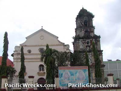 Justin Taylan 2005 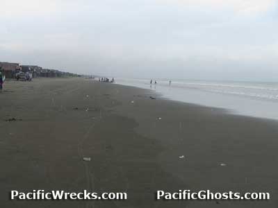 Justin Taylan 2005 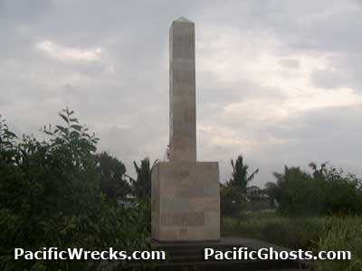 Justin Taylan 2005 |
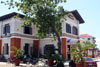
Location Lat 16° 1' 56N Long 120° 16' 8E Binmaley is located in 2nd District (District II) of Pangasinan Province in the Ilocos Region (Region I) of northern Luzon in the Philippines. Borders Lingayen Gulf to the north, Lingayen to the west, Dagupan to the east and San Carlos City to the south. Binmaley Town Hall (New) Completed in 2006, the new town hall has photographs of each of the town's mayors. Wartime mayors was Mino M. Ferrer (1937-1946). Binmaley Cathedral This Catholic cathedral in the center of town was built during the Spanish era. Its old bell is displayed outside, dated 1890. Yellow Beach On January 9, 1945 code named "Yellow Beach" site of the U.S. Army landing in the XIV Corps area. The Americans met little resistance and quickly moved inland. Today the quite stretch of beach has only small fisherman shacks for their boats at the edge of the beach. Memorial Marker On yellow beach at Barangay San Isioro Sur is a memorial marker commemorating the landing. Never completed due to lack of funds, the marker has no plaque or engraving. It was planned to be part of a memorial park and beachfront resort that never materialized. Binmaley Airfield This airfield was built by the US Army after the January 1945 landing Ki-21-IIb Sally Manufacture Number 4262 Crashed January 1945 Contribute
Information Last Updated
|
Map January 9-17, 1945 Map Lingayen Area 1945 Map Fallingrain |
| Discussion Forum | Daily Updates | Reviews | Museums | Interviews & Oral Histories |
|