Missing In Action (MIA)
Prisoners Of War (POW)
Unexploded Ordnance (UXO)
Chronology
Locations
Aircraft
Ships
Submit Info
How You Can Help
Donate
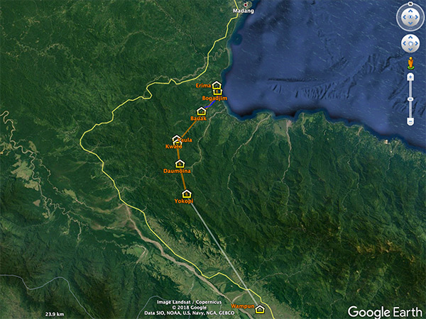
Satellite view of the
Bodadjim Road (Bogadjim-Yaula Road)
in Madang Province, Papua New Guinea
On the north coast of New Guinea is
Bodadjim
and an orange line indicating the approximate path of the
Bodadjim Road (Bogadjim-Yaula Road)
to the southwest via Bauak to Kwato and
Yaula
then onward to Daumoina and
Yokopi
in the into the
Finisterre Range
. The white line is the track to the
Ramu Valley
to Sanewas near Wampun. The blue line is the
Mindjim River (Minjeng River)
. The yellow line is the present day Ramu Highway spanning from
Madang
to
Lae
.
Credit: Google Earth
Date: December 13, 2015
Map
High Resolution Version
Acquire This Image
|
Contribute Information
Do you have photos or additional information?
Previous Page
Discussion Forum
Daily Updates
Reviews
Museums
Interviews & Oral Histories
Pacific Wrecks Inc.
All rights reserved.