 |
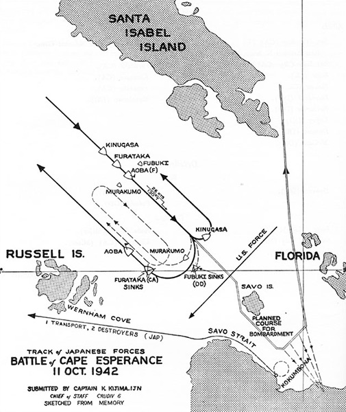
Track of Japanese Forces Battle of Cape Esperance 11 October 1942
Map showing the tracks the planned course for the shore bombardment of Henderson Field by Rear Admiral Aritomo Gotō including Kinugasa, Furutaka (sunk), Aoba flagship of Rear Admiral Gotō, Murakumo and Fubuki (sunk). The black line at center represents U.S. Navy forces. The lower black line indicating the successful landing and withdrawal of the resupply convoy: 1 transport, 2 destroyers (Jap) led by Rear Admiral Takatsugu Jojima.
Submitted by Captain J. Kijima, IJN Chief of Staff CRUDIV 6 Sketched From Memory. Visible is the Santa Isabel Island, Florida Islands, Russell Islands, Wernham Cove, Savo Island, Savo Strait and Kokumbona on Guadalcanal in the Solomon Islands.
Credit: USN Date: October 11, 1942–October 12, 1942
Map
High Resolution Version
Acquire This Image |
Contribute Information
Do you have photos or additional information?
Previous Page
|
|