 |
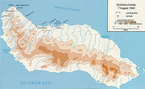
Map of Guadalcanal in the Solomon Islands
Indicated is Kokumbona, Point Cruz, Mount Austen (Mt. Austen), Lunga Point, Red Beach, Tenaru, Koli Point, Doma Cove, Tenaro, Cape Esperance, Visale, Marovovo and Verahue.
Bodies of water including Iron Bottom Sound, Sealark Channel, Aola Bay, Beaufort Bay and Solomon Sea.
Credit: U.S. Army Date: August 7, 1942
Map
High Resolution Version
Acquire This Image |
Contribute Information
Do you have photos or additional information?
Previous Page
|
|