|
|
|
|
| Missing In Action (MIA) | Prisoners Of War (POW) | Unexploded Ordnance (UXO) |
| Chronology | Locations | Aircraft | Ships | Submit Info | How You Can Help | Donate |
|
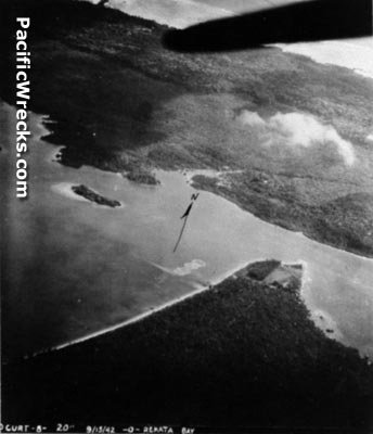 Target Approach September 15, 1942 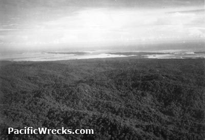 USAAF January 4, 1943 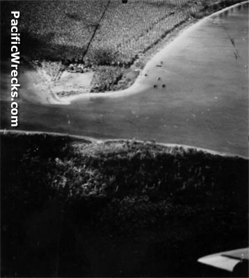 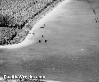 USN c1943 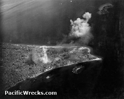 USN May 3, 1943 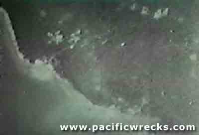 5th BG August 5, 1943 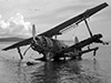 RNZAF August 28, 1945  Geoffrey White, 1987 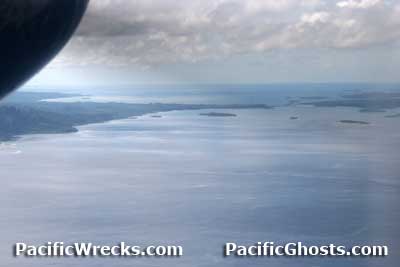 Justin Taylan 2006 |
Location Rekata Bay Seaplane Base was located in Rekata Bay bordering Suavanao Point on the eastern coast of Santa Isabel Island. Offshore to the north is Papatura Island (Patatura Fa). Construction On May 2, 1942 the Rekata Bay area was occupied by the Japanese and developed as a forward seaplane base for seaplanes and flying boat operations. Wartime History Rekata Bay was used by the Imperial Japanese Navy (IJN) as a seaplane base and operating area. During May 1942 floatplanes from the Kamikawa Maru and Kiyokawa Maru operated from this location. Between September to November 1942 based the R Homen Koku Butai (R Area Air Force). During the Guadalcanal campaign, many night harassment missions by Japanese floatplanes were initiated from Rekata Bay to harass Allied positions. The Americans dubbed these floatplanes were dubbed "Washing Machine Charlie" due to the sound of their unsynchronized engines. Japanese units based at Rekata Bay R Homen Koku Butai (R Area Air Force) September–November 1942 Kamikawa Maru air group (F1M2 Pete) May 3, 1943 Kiyokawa Maru air group (F1M2 Pete) May 3, 1942 802 Kokutai arrives early December 1942–Jauary 1943 departs Shortland During the Guadalcanal campaign, Rekata Bay was a location where damaged Japanese aircraft could make emergency landings or ditching when returning from missions against Tulagi or Guadalcanal. Afterwards, Japanese pilots and air crews could be flown back to their bases on Bougainville or Rabaul. The Rekata Bay area was attacked by Allied bombers and fighters starting on August 7, 1942. The area was defended by Japanese seaplanes and anti-aircraft gun positions. Bombing and strafing missions continued until the end of August 1943. Allied missions against Rekata Bay August 7, 1942–August 30, 1943 Walter Lord writes in Lonely Vigil: "Japanese anti-aircraft gunners at Rekata Bay, who seemed to be the best in the business." By late August 1943 after the Japanese defeat on New Georgia the remaining garrison withdrew from the Rekata Bay area location by barge to join forces further to the northwest. Japanese aircraft wrecks at Rekata Bay Sometime between September to November 1943 a team of Americans from Technical Air Intelligence Unit (TAIU) visited Rekata Bay to investigate the Japanese aircraft wrecked or abandoned at this location. Their survey was reported in Crashed Enemy Aircraft Report No. 17 (CEAR No. 17) released February 15, 1944. At Rekata Bay they found 7 x F1M2 Pete, 2 x Zeros, 3 x G4M1 Betty, 2 x E7K Alf and 1 x E13A Jake all in wrecked condition or crashed. It is unclear if any of the wrecks were removed, most likely they were only studied on site. In March 1944 a RNZAF Catalina landed at Rekata Bay. Aboard was Lt. Frederick W. McConaghy, RANVR a member of the the staff of the Deputy Supervising Intelligence Officer (DSIO), Naval Intelligence, Royal Australian Navy supporting coastwatcher Lt. F. A. "Snowy" Rhoades, RANVR in northern Santa Isabel Island. During this visit, personnel including Flight Lieutenant J. Beattie the Royal New Zealand Air Force (RNZAF) inspected the wreckage of F1M2 Pete 1190 Tail YII-2. On August 5, 1945, RNZAF PB2B-1 Catalina NZ4051 from 6 Squadron landed at Rekata Bay and investigated the crash of Hudson NZ2054 presumed to have crashed in the area and located the wreckage but no trace of the crew. On August 28, 1945, a RNZAF Catalina from 6 Squadron again landed at Rekata Bay for a picnic and to inspect the former Rekata Bay Seaplane Base. On this visit, one member of the group LAC Leslie Angus Ellen, 441559 went missing. It was believed he drown or was taken by a saltwater crocodile. He is memorialized at Bourail New Zealand War Cemetery on the Bourail Memorial, panel 8. Jenny Anthea adds: "My father was on that trip and I have confirmed from several sources including my father that LAC Leslie Angus Ellen, NZ441559 age 21 was taken by a croc on the return swim to the PBY. He was reported missing at 15:00. According to my father’s account aircraft returned to Rekata Bay for several days afterwards and dropped depth charges in the belief a croc would have stored his body under a log or ledge they dropped depth charges but Ellen’s body was never recovered." Today Abandoned since the war. In the early 1990s, when Suavanao Airport was built or expanded on Suavanao Point. Geoffrey White reports: "I visited Suavanao in 1987 and 2002. Not much, and a lot less today." Then, logging began in the area, establishing its its base camp at Suavanao. In the early 1990s they developed the point area, built the airfield, logging camp and dock area for timber. After a brief period of inactivity in the late 1990s to 2003 during the 'tensions', the logging has resumed. Although the logging company, Earthmovers, claims it never interfered with any war relics, none remain on the point area the developed. Japanese guns at Suavanao Point were either bulldozed and buried or otherwise disappeared. Justin Taylan visited the site in February 2006: "I was disappointed there was so little in the area. I searched and found no traces of the Japanese base there, aside from the empty mount of a twin anti-aircraft gun. No bottles, or other small relics of Japanese occupation remained. The water quality in the whole area was poor due to the logging." References Crashed Enemy Aircraft Report (CEAR) No. 17 dated February 15, 1944 WW2 Nominal Roll - Frederick W. McConaghy, RAN CWGC - Leslie Angus Ellen Thanks to Geoffrey White, Ewan Stevenson, Richard Dunn and Jim Long for additional information Contribute
Information Last Updated
|
August 20, 1943 Photo Archive View in Google Earth |
| Discussion Forum | Daily Updates | Reviews | Museums | Interviews & Oral Histories |
|