 |
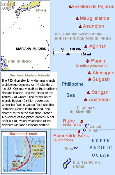
Map of the Mariana Island Group (Mariana Islands)
Borders the Philippine Sea and the North Pacific Ocean.
The Northern Mariana Islands is the Commonwealth of the Northern Mariana Islands (CNMI) and includes Farallon de Pajaros, Maug Islands (Ma'ok), Asncion Island, Agrihan Island (Agrigan), Pagan Island, Alamagan Island, Guguan Island, Sarigan Island, Anatahan Island, Fallon de Madinila, Ruby, Saipan Island, Tinian Island, Aguijan Island (Aguihan, Aguijan), Esmeralda Bank (submarine island) and Rota Island (Luta).
The South Mariana Islands is the Territory of Guam including Guam Island.
Credit: Wikipedia Date: 2008
Map
High Resolution Version
Acquire This Image |
Contribute Information
Do you have photos or additional information?
Previous Page
|
|