|
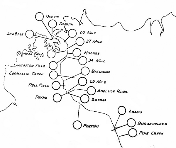
Map of airfields in Northern Territory (NT) in Australia
Darwin (RAAF Station Darwin), Darwin (Parap Airfield, Darwin Civil Aerodrome, Ross Smith Aerodrome), Sea Base [Darwin Seaplane Base], 20 Mile, 27 Mile, Strauss Field (28 Mile), Hughes Field (30 Mile), 34 Mile, Livingstone Field ( 34 Mile), Coomallie Creek (Coomalie Creek Airfield, Coomalie Airfield), Batchelor Field (RAAF Batchelor), Pell Field, 65 Mile, Payne Field, Adelaide River, Brooks, Fentons (Fenton Field), Adams, Burkeholder (McDonald), Pine Creek Field The black line indicates the Stuart Highway.
Credit: USAAF Date: 1943
Map
High Resolution Version
Acquire This Image |
Contribute Information
Do you have photos or additional information?
Previous Page
|
|