 |
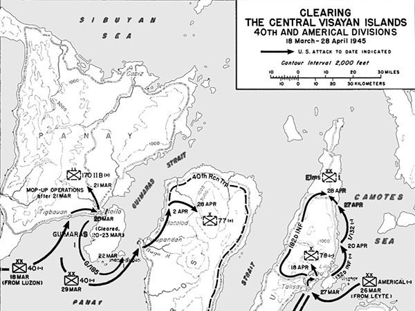
Map Clearing the Central Visayan Islands 40th Division and Americal Division March 18–April 28, 1945
The map shows the Central Visayan Islands in the Philippines including Panay Island with Tigbauan and Iililo and Guimaras Island, Negros Island with Pulupandan (Palupandan, Puhipandan) and Bacolod, and Cebu Island with Cebu City, Liloan, and Talisay and Mactan Island and Bohol Island. Also indicated is the Sibuyan Sea, Guimaras Strait, Camotes Sea, Bohol Strait (Cebu Strait), Sulu Sea and Mindanao Sea (Bohol Sea).
Credit: Triumph in the Philippines Chapter XXXI Date: March 18, 1945–April 28, 1945
Map Enlargement
High Resolution Version
Acquire This Image |
Contribute Information
Do you have photos or additional information?
Previous Page
|
|